wind farms
We use specialized software to simulate the weather in a region and determine the annual net electricity production. Specialized studies for most wind farms in Romania.
read more
airports & heliports
Master Plan for the airport, technical projects, technical consultancy, details for execution planning, elaboration of feasibility studies, obstacle studies, location research
read more
geodesy, topography & cadastre
Topographical, cadastre and registration documentation, marking
more
research
Geodesy, topography and Cadastre
GEODESY

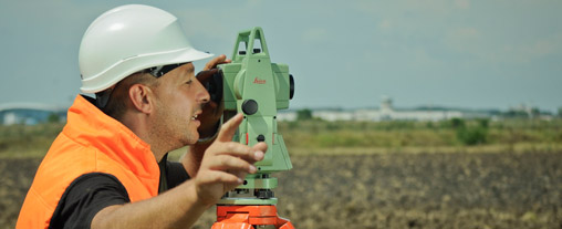
SC GEO ARC LTD carries out planimetric and altimetric support networks needed for various jobs, such as:
- precise localization of certain details in the field;
- carrying out feasibility studies;
- photogrammetric landmark;
- development of maps and plans;
- development of longitudinal and transversal profiles;
- implementation or localization of utility networks;
- production of digital terrain or surface model;
- computation of volumes.
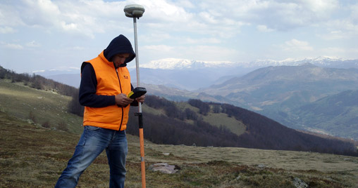
Depending on the precision required for each type of job in hand, we are using the following measuring instruments:
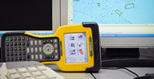
- GPS receivers (Trimble 5700, Trimble R6)
- RTK systems (Trimble)
-
total stations (Leica TCR 407 Power, Trimble 3305);

- levels (Leica Sprinter).
 MAGNETISM
SC GEO ARC SRL carries out magnetic declination determinations using the Bartinghton magnetometer.
TOPOGRAPHY & CADASTRE
SC GEO ARC SRL conducted the following types of work:
Topographic lifting
- Topographical plans necessary for the design of dykes, dams, simulation flooding of adjacent areas;
- Technical documentation expressed in WGS-84 system required to obtain advice from AACR for objectives (construction, planning, activity, etc.). to be made in areas of aviation servitudes;
- Topographical works (specific for airport activity) required to achieve and / or update of aeronautical charts;
- Topographical plans, general urban plans, documentation support of the general urban plans, the regional urban plans, the detailed urban plans;
- Topographic plans necessary for Drawing up the documentation to authorize construction and demolition work,
- Topographic documentation, according to GD nr.834/1991, as amended and supplemented;
- Preparation of longitudinal and transverse profiles of lands, street grating etc..;
- the calculations of excavation / filling volumes;
- Situation plans required to obtain different approvals;
- Parceling plans.
Cadastre and tabulation documentation
- Technical documentation first registration buildings not listed in the land register,
- Technical documentation for detachment / annexation,
- Technical documentation for registering a new building in the land register;
- Technical documentation on updating / adjustments of cadastre, property boundary changes and / or altering the surface estate;
- Dismantling of the apartment buildings, boxes, garages and common parts ;
- Documentation for final removal from the agricultural circuit of lands within or out of the built-up areas
- The technical documentation necessary to obtain the OCPI technical approval of Urbanism Certificate / Building Permit Project (CAP), or obtain postal code;
Tracings
- Tracing and materialization of the field axes from conceptual project;
- Property boundaries poling;
- Tracing slope lines and quotas;
- Verification of verticality, building movements and deformations;